Input Data
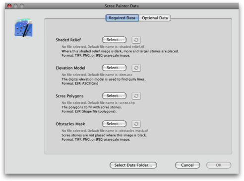
Scree Painter requires a set of input files to generate scree. All data are loaded through a single dialog that appears when you launch Scree Painter.
Press the Select buttons to load various files. Press the buttons with the round arrows to reload a file after it has been edited with another application.
Press the Select buttons to load various files. Press the buttons with the round arrows to reload a file after it has been edited with another application.
There are two groups of input data: Required Data and Optional Data. Optional data can be removed by clicking the corresponding Clear button.
Click the Select Data Folder to load multiple files from a single folder. Files must use default names, which are indicated in the dialog while no files are selected.
Click the Select Data Folder to load multiple files from a single folder. Files must use default names, which are indicated in the dialog while no files are selected.
Required Data
Shaded Relief
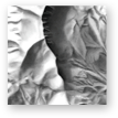
A shaded relief adjusts the density and the size of scree stones. Where the shading image is darker, scree stones are denser and larger. The shaded relief also adjusts the density of gully lines: where the shading is darker, more gully lines are generated.Format: grayscale image with world file.
Elevation Model
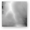
A digital elevation model (DEM) is required to compute gully lines.Format: ESRI ASCII Grid.
Scree Polygons
These vector polygons are filled with scree.Format: ESRI Shape file
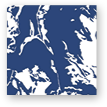
Obstacles Mask
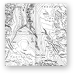
No scree stones are placed where this image is not white. This is to avoid that scree dots overlap other map elements, or are too close to other map elements.Format: grayscale or RGB image.
Optional Data
Large Stones Mask
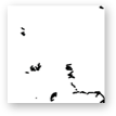
Scree stones are enlarged where this mask image is black. This mask can be quickly painted with Photoshop or other raster graphics software. This is a binary mask, i.e. gray values are treated as black values.Format: binary or grayscale raster image.
Gradation Mask
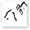
An alternative gradation curve is applied to the shaded relief image where this image is dark. This allows for local adjustments of the density and size of scree stones, which is useful to accentuate small details, such as glacial moraines. This mask can be quickly painted with Photoshop or other raster graphics software.Format: grayscale raster image.
Gully Lines
Gully lines are usually derived from the digital elevation model, but alternatively they can be read from a file.Format: ESRI Shape file.
More >>
Reference Image
An arbitrary georeferenced raster image for visualization only.Format: grayscale raster image.
